Routeburn Track tour
2010
Google Earth has the facility to record what it calls ‘tours’: predetermined flights through the terrain along tracks provided to it. Using GPS track data from walkers who had completed it before, I mapped out the walk and created the tour embedded below.
The Google Earth browser plugin must be installed to see the tour. If you have the Google Earth application, download the tour file, and open it in Google Earth. Double click the tour to play it back in Google Earth. Google Earth is a free download.
Routeburn Track
4/05/10
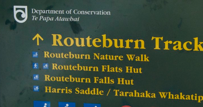
In April 2010 I travelled to New Zealand to walk the Milford and Routeburn tracks. Before setting out, I previewed the walks with Google Earth tours. This is the Routeburn tour.